Seeing as Apple and Google are now providing public transport directions in their iPhone Maps application, I'd better release this site I made last weekend. It's a bit different in that it shows the whole of any given (London) bus route - the idea being that it's useful when you're on a bus but not sure where the route goes.
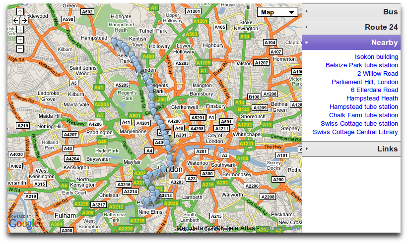
Enter a route number to display the stops (and switch between alternate routes in the sidebar). A click on a marker or a stop name will show a blow-up map for that location (which can be maximised to show a StreetView of that location, or at least it would if StreetView was available in London). A selection of Wikipedia items near that stop will also be displayed, so you can use this to explore locations along the route; again, these maximise to show the whole Wikipedia page inline.
At the moment if you load the site on an iPhone you can only view and pan the map, as embedded Google Maps don't currently receive click or zoom events, but I'll try and add extra iPhone-specific controls soon, and try to use PhoneGap to make it into an application that can fetch precise location information from the phone (as Google's ClientLocation property only gives city/IP address levels of accuracy).