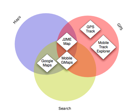
The K800i runs Java/J2ME applications, as opposed to Symbian, and has Bluetooth so can communicate with external GPS devices like this one. There are quite a few mapping applications available, some of which collect and store GPS information, some of which search and display maps, and some of which take GPS information and display your location on a map. There doesn't seem to be any one that reliably does all of the above, yet.
- Google Maps (official) provides search, directions and maps.
- GPS Track collects, saves and transmits GPS tracks, but doesn't store timestamps and is a bit awkward.
- Mobile Trail Explorer collects and saves GPS tracks in a nice straightforward interface.
- J2MEMap shows your location on a map, stores GPS tracks, geotags and sends photos to Flickr and lots of other things, but is really buggy.
- Mobile GMaps shows your location on a map and, in the latest alpha release, sends your current location to a web server. No export yet though, and the interface is a bit awkward.
